Cirque de Gavarnie Hiking Guide: Everything you Need to Know
Last Updated June 2026
This Cirque de Gavarnie hiking guide will show you all the reasons this hike is nothing short of incredible! I’ve tackled epic trails in Canada, New Zealand, the Dolomites, and more, but the Cirque de Gavarnie instantly shot up near the top of my all-time favourite hikes! And here’s the best part: despite the jaw-dropping scenery, it’s surprisingly accessible.
You don’t need to be an expert hiker to experience towering 3,000-meter cliffs, France’s tallest waterfall, and sweeping alpine vistas that make this spot legendary. Whether you’re chasing panoramic views or just want a serene walk in one of the most beautiful corners of the Pyrenees, this hike delivers big rewards for relatively little effort.
In this Cirque de Gavarnie hiking guide, I’ll cover everything you need to know to make the most of this unforgettable day hike – from different trail options and how to get there, to the best time of year, what to pack, and insider tips to help you enjoy every moment.
This post may contain affiliate links. I only include links to sites and services that I genuinely use or recommend after careful research, and you will never pay more by using them.
Overview & Travel Tips
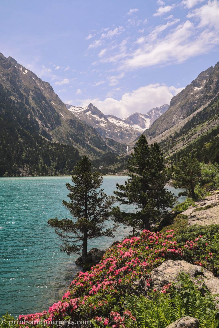
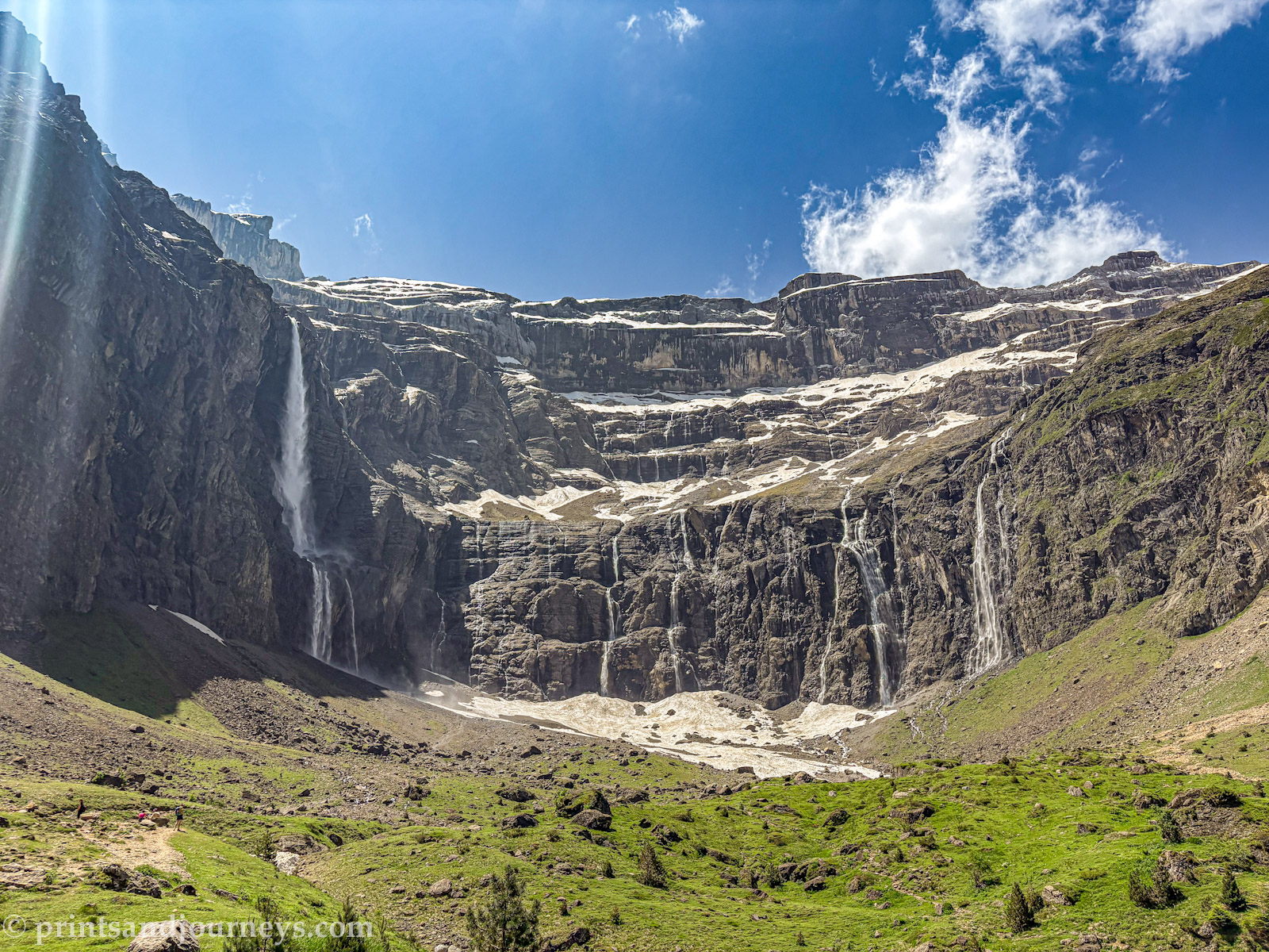
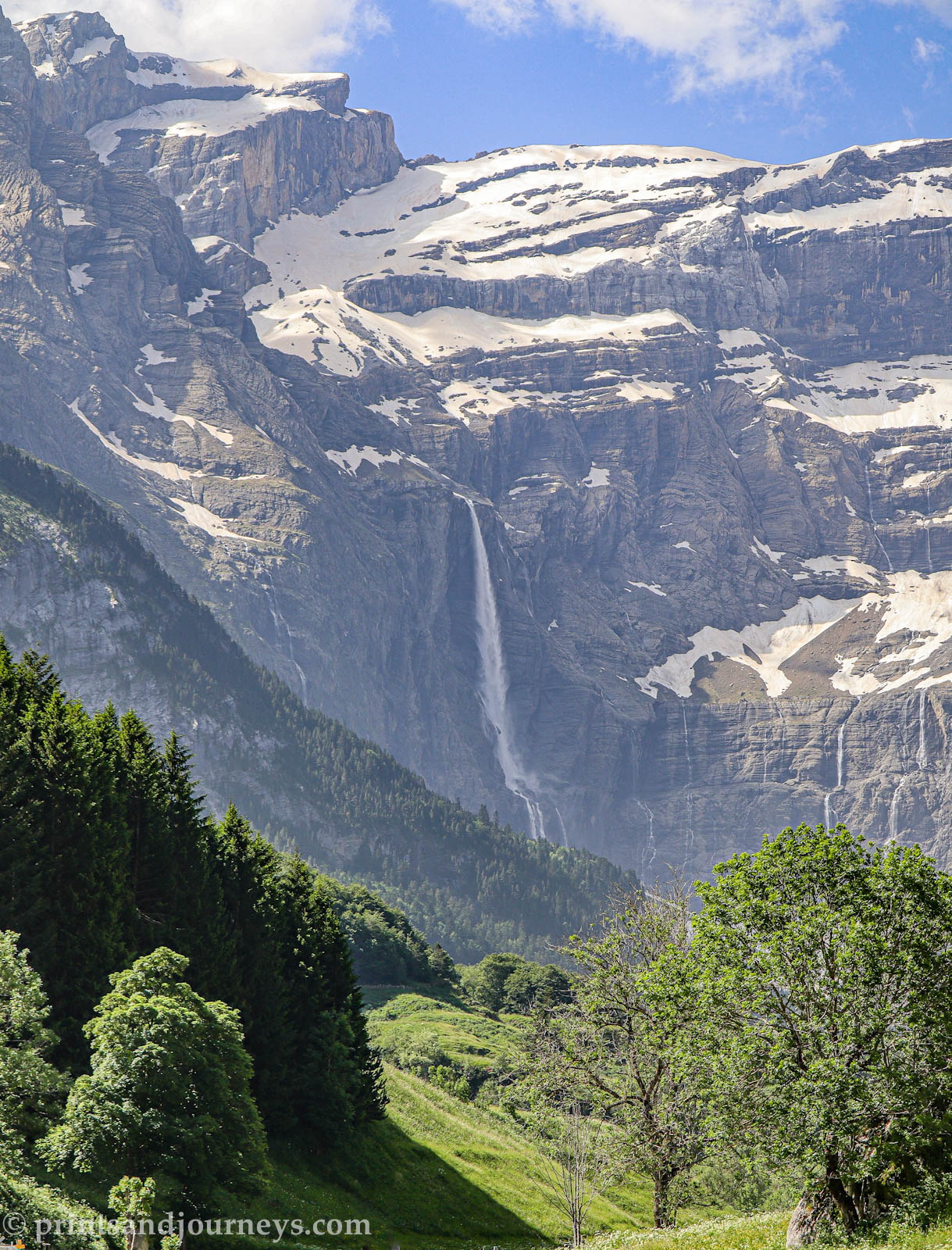
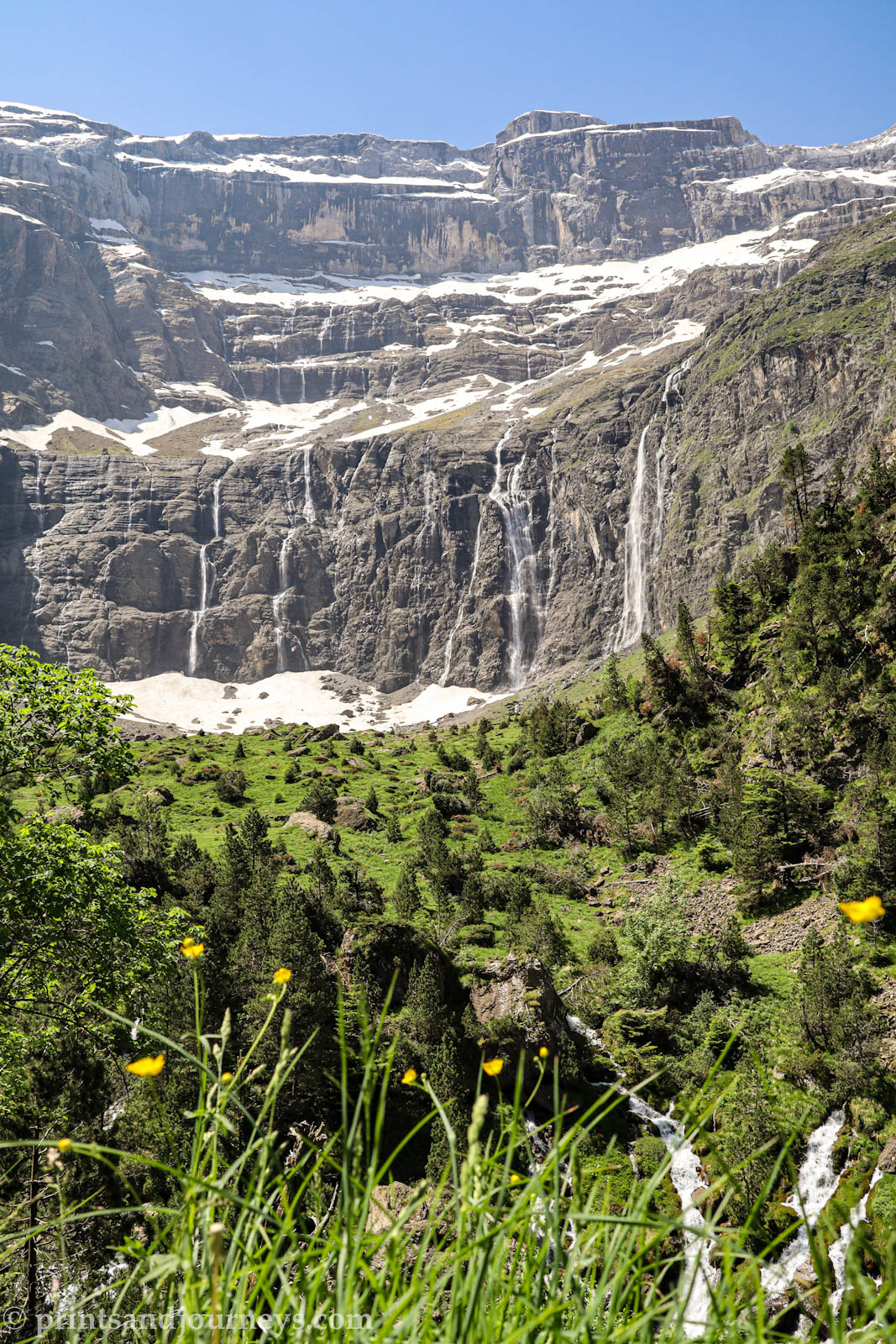
The Cirque de Gavarnie is a jaw-dropping natural amphitheatre carved over thousands of years: towering cliffs, cascading waterfalls, and a valley that feels straight out of a movie. It’s worth the trip: the main path is accessible for most hikers, but the full experience is best enjoyed with a bit of time and planning. My Cirque de Gavarnie hiking guide tips will help you make the most of your day ☺️.
• Go early: Trails can get busy, especially in summer. Early morning visits often mean fewer crowds and better photos.
• June or September are the best times to go
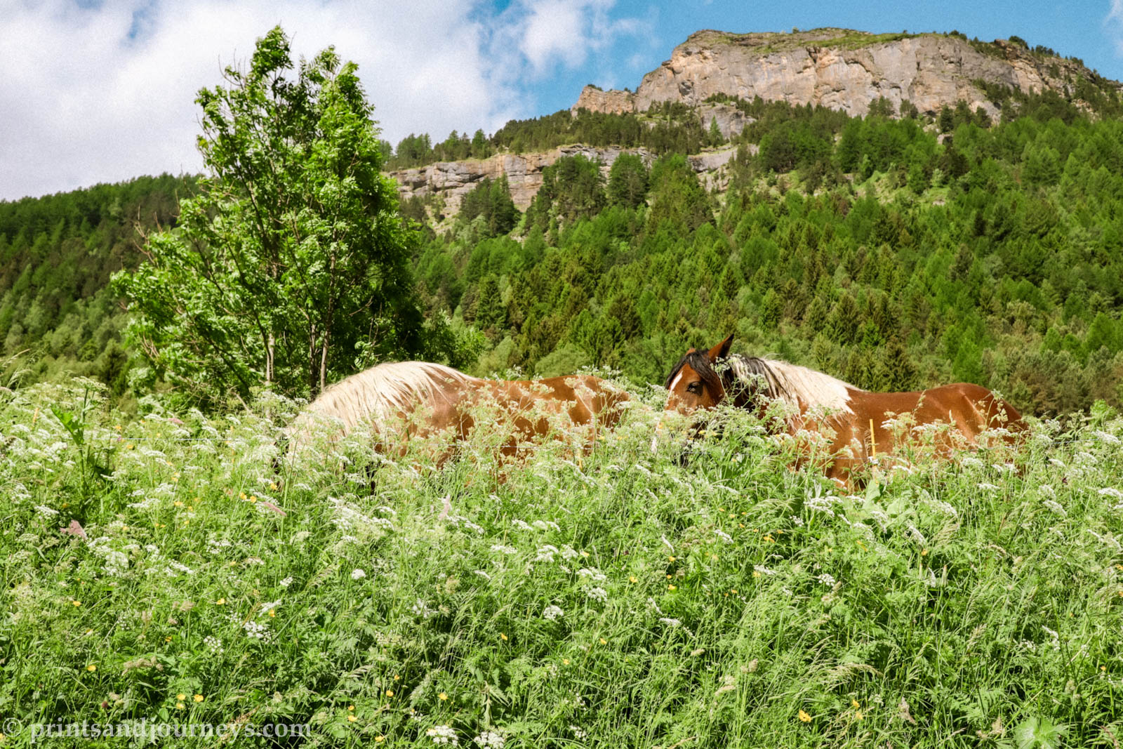
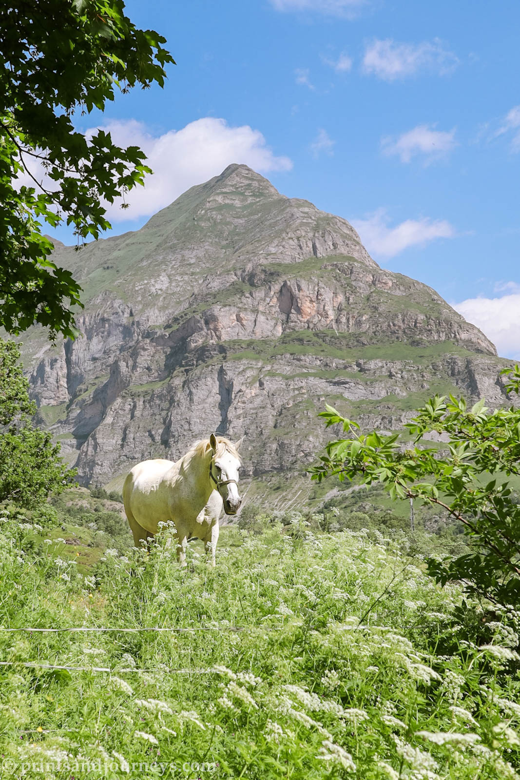
• Look for livestock: Sheep, horses along the way
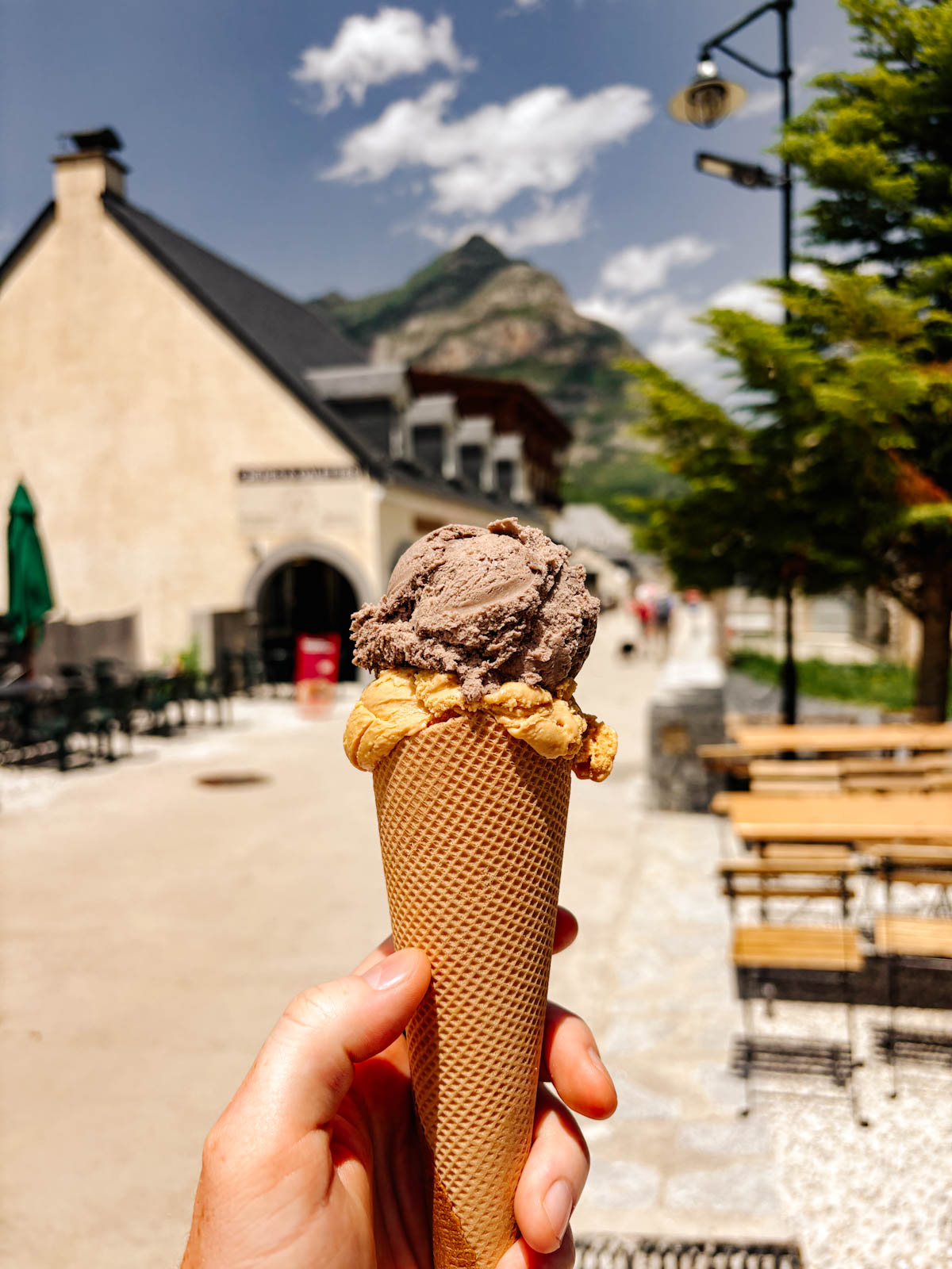
• Gelato reward: On your way back, stop at Praline et Marguerite in Gavarnie for some creamy gelato, a sweet way to celebrate a great hike.
• Extra waterfall trek: Definitely make the detour to the base of the Grande Cascade. The views are worth it, but you may have to cross small rivers – pack an extra pair of socks just in case.
• For a detailed travel itinerary, check out my 2 day Pyrenees travel guide.
For more information on the Pyrenees, check out my other travel guides: 2-day Pyrenees itinerary and the complete Pyrenees travel guide.
Route Options
Best Hiking Routes at Cirque de Gavarnie: Main Path, Bellevue Plateau, and Espugues Cornice
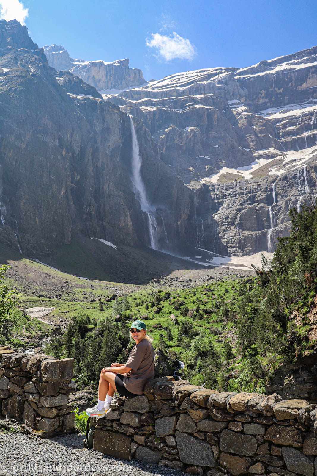
There are three main hiking routes that lead from the village of Gavarnie to the base of the cirque. No matter which one you choose, all trails meet at the Hôtel du Cirque, from where you can continue to the Grande Cascade – the tallest waterfall in France! When I went, I made a lil mistake 🤭: I just followed the crowds along the main valley path without realizing there were other routes that offer even more views. If I could do it again, I’d actually combine option 2 & 3 below into a circuit. Oh well, all roads lead to Rome (the big hotel and viewpoint) on this one!
1. The Main Path (Chemin Principal)
- Distance: 8 km return
- Time: 2-3 hours return
- Difficulty: Easy
- Elevation Gain: 288 m
This is the classic out-and-back route most visitors (like me) take. The trail follows a wide gravel road along the valley floor, with gradual elevation and plenty of space. You’ll start with big views of the cliffs, wander along the river, and pass through forested stretches before reaching the Hôtel du Cirque.
It’s perfect if you want something straightforward, are short on time, have limited mobility or are traveling with pets or kids. But compared to the other two options, it’s apparently the least dramatic.
2. The Espugues Cornice
- Distance: 11 km return
- Time: ~4-6 hours return
- Difficulty: Moderate
- Elevation Gain: 442 m
This route runs along the eastern side of the valley and is the steepest of the three. After a series of switchbacks through the forest, you’ll reach Chalet de Pailla before the trail eases into a gradual descent along the rocky cornice.
The views here sounds amazing, you’re right under the cliffs streaked with waterfalls. Along the way, don’t forget to look back toward the village for sweeping valley views.
Navigation tip: Signs don’t always say “Espugues Cornice.” Follow markers toward Refuge des Espuguettes and then Chalet du Pailla to stay on track.
3. The Bellevue Plateau
- Distance: 12 km return
- Time: ~4-6 hours return
- Difficulty: Moderate
- Elevation Gain: 460 m
This is often called the most scenic approach to Gavarnie. From the village church, the trail climbs gently through forest, then up a stretch of rocky switchbacks. Once you reach the plateau, it’s jaw-dropping – wildflower meadows, open panoramas, and perfect views of the Grande Cascade from a distance.
You’ll cross a few rivers before rejoining the main path for the last push to Hôtel du Cirque.
Bonus Route: Hôtel du Cirque to the Grande Cascade
- Distance: 2.4 km return
- Time: 30 minutes return
- Difficulty: Easy–Moderate
- Elevation Gain: 225 m
No matter which route you take, don’t stop at the hotel, walk the final stretch to the base of the Grande Cascade. Standing directly under France’s tallest waterfall as it crashes down the cliffs is unforgettable. There’s a great photo spot just past the hotel with this rock wall in the foreground and perfect cut out to sit!
Expect to cross a few creeks (hence the extra socks) and get misted by the spray when you’re close to the waterfall!
5. Recommended Loop
If you’re up for a longer day hike, the best circuit is:
- Up via the Bellevue Plateau (option 3)
- Down via the Espugues Cornice (option 2)
This loop is about 13.5 km, 960 m gain, and 4–6 hours depending on your pacing and breaks. It combines the best views in both directions and avoids hiking the same path twice.
Getting There
How to get to Cirque de Gavarnie: Car, Bus or Tour
The Cirque de Gavarnie is tucked away in the French Pyrenees, but it’s surprisingly easy to reach once you know your options. I’ll break it down into the three main ways: by car, by bus, or on an organized tour.
Option 1: By Car 🚗 (highly recommended)
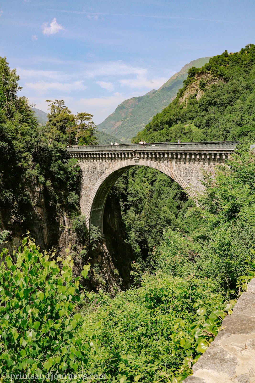
If you’re staying in any of the nearby Pyrenean villages (I stayed in Lourdes as I found it had cheap accommodation options), the simplest way is to drive. All roads funnel onto the D921, which is the main road leading straight into the village of Gavarnie. If you are driving, stop at Pont Napoleon on your way to see a beautiful stone bridge over a deep lush valley. The drive is beautiful, I encourage a pit spot whenever you see a view!
Once you arrive, there’s a large public parking lot right by the entrance of the village. Parking costs about 8€ for the day and card is accepted. From there, it’s a short walk through the charming village streets before you reach the trailhead.
Option 2: By Bus 🚌
If you don’t have a car, the bus is a solid option, especially in summer when service runs regularly. From Luz-Saint-Sauveur, you can catch a direct bus to Gavarnie that operates several times a day during peak season (July and August). Outside of summer, the schedule is more limited, so check ahead. Tickets are affordable and can be purchased directly on board.
The ride itself is scenic, winding along the valley and giving you a preview of the mountains before you even arrive. The bus drops you right in the village, only minutes from the start of the trail.
Option 3: By Tour from Lourdes 🚌
For a hassle-free option, you can also join a guided tour from Lourdes. When researching online this GetYourGuide tour was the only one I found, and I know this is a reputable company. These tours usually include round-trip transport, a stop in Gavarnie village, and enough free time to hike to the cirque at your own pace. It’s a great choice if you’re short on time, don’t want to deal with logistics, or simply prefer having everything arranged in advance.
When to Visit
Best Time to Visit Cirque de Gavarnie for Hiking and Scenic Views
The Cirque de Gavarnie is stunning in every season, but timing your visit can make the difference between the amount of people you are sharing it with. Weather, snow conditions, and even the angle of the sun all play a role in how you’ll experience it.
Late Spring (May – Early June) 🌱
Trails at lower elevations are usually clear by May, but the higher-altitude paths into the cirque can still hold snow. Some years, parts of the trail may be icy or even blocked, making the hike more difficult. It could be a risk to book at this time, but the main path at lower elevation should be clear and you’d be able to see the main view at the least!
Summer (June – Early October) ☀️
This is the most common time to visit, with snow-free trails, long daylight hours, and plenty of services open in Gavarnie village. July and August especially are peak season, which means the trail can get busy.
💡 Tip: Arrive early in the morning (before 10am if you can) to enjoy the path with fewer crowds. It also makes parking easier and gives you quieter moments inside the cirque.
Autumn (Mid October – November) 🍂
Crowds thin out, and the cirque takes on rich autumn colours. Lower trails are usually still clear, but higher sections can see snow return by late October. This can be a great sweet spot for quieter hiking and dramatic scenery.
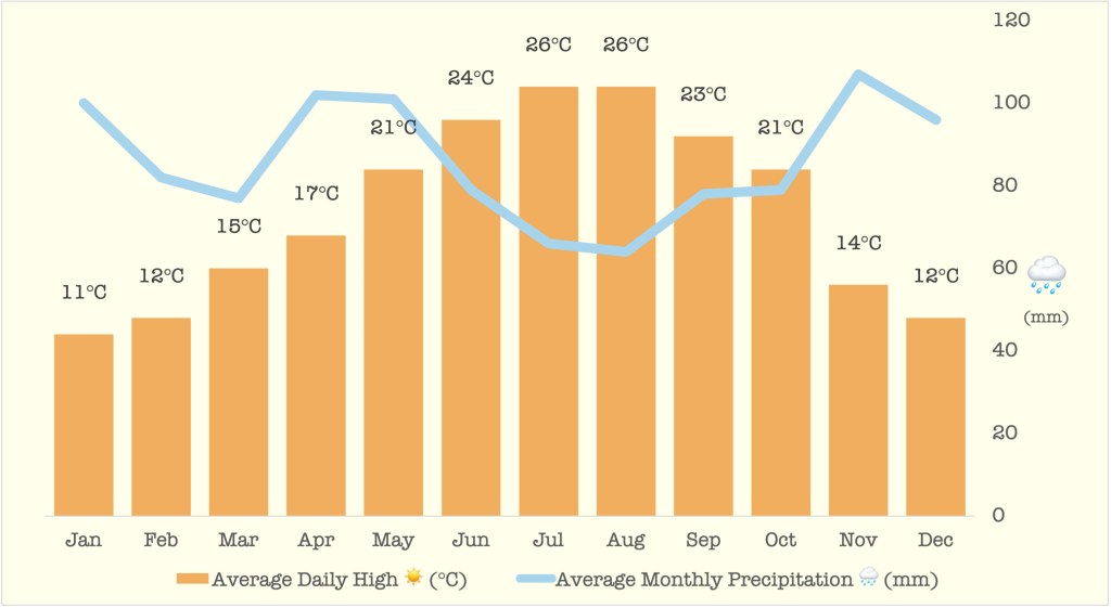
Winter (December – April) ❄️
Winter transforms the cirque into a snow-covered amphitheater. The trail becomes a snowshoe or ski-touring route rather than a simple hike, and you’d need a vehicle ready to tackle steep, snowy mountain roads. Doable if you are comfortable in these conditions and can plan ahead, I bet it’d be a great adventure! I’ll stick to the summer time myself.
Best Overall Months
For the best mix of conditions and manageable crowds, aim for June or September. June gives you snow-free trails with fewer people before the July rush, while September offers crisp air, golden light, and a calmer vibe after summer.
Packing List
Essential Packing List for Cirque de Gavarnie: Hiking Gear, Clothing, and Food
To make the most of your adventure, this Cirque de Gavarnie hiking guide lists essential gear, clothing, and food for the hike.
- Water – Seriously, bring plenty. Either pack a lot or have a little filtration system with you. Being thirsty on the trail is never fun.
- Small backpack – For carrying all of this stuff.
- Food & Snacks – I strongly suggest packing a lunch. Grab a sandwich or panini in one of the villages, or pick up some local charcuterie. Trust me, finding a nice patch of grass at the top to sit and eat while staring at those cliffs is 100% worth the extra planning. Plus, it’s like a reward right?
- Shoes: Running or Hiking – We hike a lot at home and only did the main path, so running shoes were perfect for us. If you want more ankle stability or are less experienced, lightweight hiking boots can help, but they’re definitely not required.
- Extra socks – If you go to the bottom of the waterfall, you’ll have to hop over some creeks along the creek. Bring an extra pair of socks in case you’re not as coordinated as we’d all like to be 😂
- Layers & Rain Jacket – Mountain weather changes fast. Check the forecast, pack a light rain jacket just in case. On our sunny June day, T-shirts, shorts, and a hat were perfect. But it’s better to have layers than regret it halfway up.
- First Aid Kit – Hopefully you don’t have to use it, but it is best to be prepared for all events that could happen.
- Sunscreen & Sunglasses – My partner is a redhead, so this is non-negotiable for us. Even if you’re not fair-skinned, a few slaps of sunscreen and sunglasses go a long way. 😎
- Hiking Poles (Optional) – We didn’t use them on the main path, but lots of folks 45+ had them. I use them all the time at home. They take weight off your knees and joints, so if that appeals to you, bring ‘em.
- Blanket (Optional) – If you’re planning to linger at the top, bring a blanket. Sit, stare at the waterfalls, lay in the sun, watch the butterflies around you, think about how amazing Earth is, ya know, soak it right up.
- Credit card or Cash (Optional) – There is a restaurant at the top where you can sit on the patio and enjoy a beer or some food. It tends to get busy so don’t count on it. When you have finished the hike and are heading through the village back to your car, stop at Praline et Marguerite and enjoy some seriously delicious post-hike gelato 🍦(we loved the Salted Caramel flavour).
If you are sticking around the area and are looking for more things to do, check out my Pyrenees Travel Guide or my 2 day Pyrenees Itinerary for delicious restaurants, other hikes and scenic spots in the area!
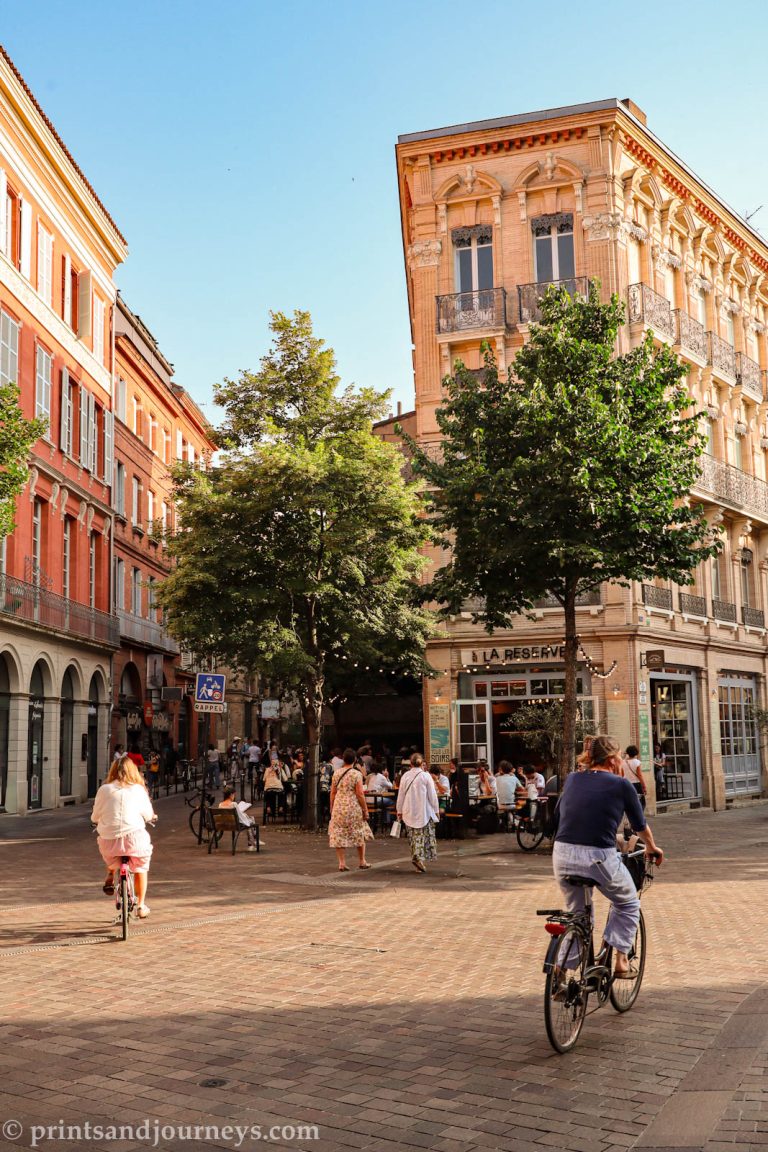
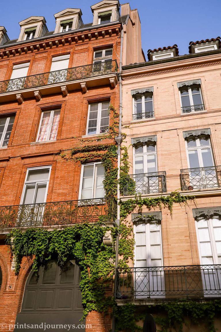
Where to go next? Head north to the Basque Coast, or south to Toulouse & Marseille!
Interactive Pyrenees Map
Save this interactive Pyrenees map to your Google Maps